No products in the cart.
Only this weekend
Super Discount
Items on sale this week
Top picks this week. Up to 50% off the best selling products.
Price (Inc. Tax): KSh116,000
When your adventures take you beyond mobile network coverage, having a dependable navigation and communication device becomes essential. The GPSMAP 67i is designed for outdoor professionals, explorers, hikers, surveyors, conservationists, emergency response teams, and adventure enthusiasts who require accurate positioning, reliable navigation, and satellite communication capabilities in remote environments. Combining Garmin’s renowned GPS technology with inReach® satellite communication, the GPSMAP 67i delivers an unmatched level of confidence wherever your journey leads.
The GPSMAP 67i stands out as more than just a handheld GPS device. It serves as a complete navigation and safety solution, allowing users to navigate challenging terrain while maintaining the ability to communicate with the outside world through the global Iridium® satellite network. Whether you are trekking through dense forests, navigating mountainous regions, conducting field research, or embarking on multi-day expeditions, this device ensures you stay connected and informed.
One of the key advantages of the GPSMAP 67i is its support for multiple global navigation satellite systems, including GPS, Galileo, QZSS, GLONASS, BeiDou, and IRNSS. This extensive satellite compatibility significantly improves positioning accuracy, especially in environments where traditional GPS signals may be obstructed by heavy tree cover, steep canyons, or urban structures. The device also incorporates multi-band GNSS technology, allowing it to maintain precise location tracking even under challenging conditions.
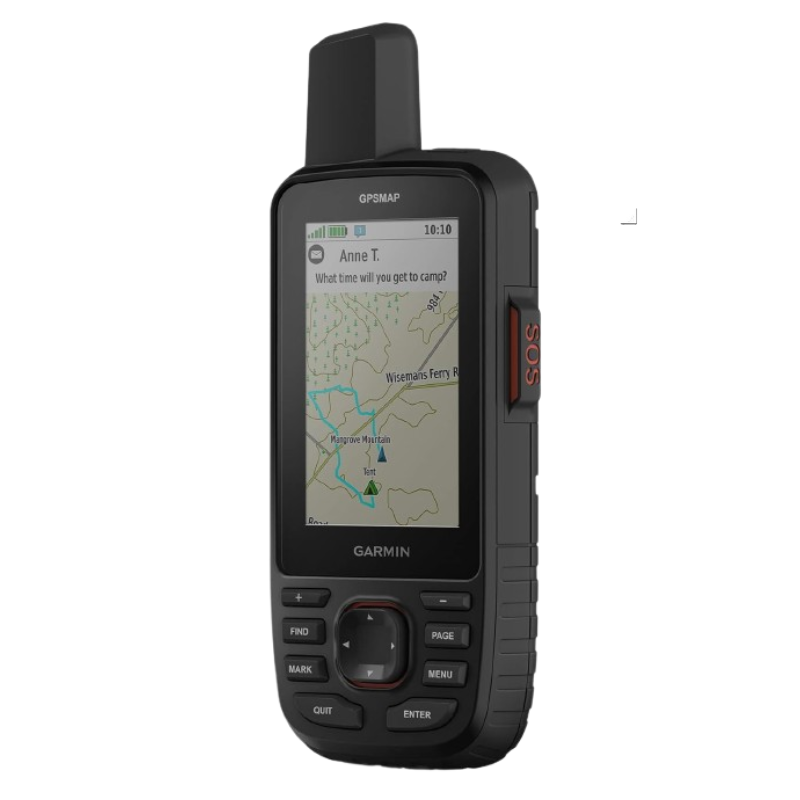
Communication is often one of the biggest challenges when venturing into remote areas. The GPSMAP 67i addresses this challenge through built-in inReach® satellite communication technology. Using the Iridium satellite network, users can send and receive two-way text messages even when outside cellular coverage. This feature provides reassurance for adventurers, field workers, and outdoor professionals who need to remain connected regardless of location.
The device also includes an interactive SOS feature that can be activated during emergencies. When triggered, the SOS signal is sent to a 24/7 emergency response coordination center, enabling rapid assistance when it matters most. This capability makes the GPSMAP 67i an invaluable safety tool for solo travelers, expedition leaders, search and rescue teams, and anyone working in remote environments.
Long battery life is crucial for outdoor adventures, and the GPSMAP 67i excels in this area. Designed for endurance, it offers up to 180 hours of battery life in GPS mode and up to 840 hours in expedition mode. With inReach tracking enabled, users can still enjoy extended operational periods, making the device ideal for multi-day hikes, long-distance expeditions, wildlife monitoring, and remote field operations.
The rechargeable lithium-ion battery eliminates the need to carry multiple spare batteries, helping reduce pack weight while ensuring reliable operation throughout your journey.
Outdoor navigation equipment must withstand demanding conditions, and the GPSMAP 67i is engineered accordingly. Its rugged construction is designed to handle harsh weather, rough terrain, and challenging environments. With an IPX7 water-resistance rating, the device can withstand rain, splashes, and accidental immersion in water, making it suitable for hiking, camping, boating, and fieldwork applications.
The physical button-based interface ensures reliable operation even when wearing gloves or working in wet conditions. Unlike touchscreen-only devices, the GPSMAP 67i allows users to maintain full control regardless of environmental conditions, enhancing usability and reliability in the field.
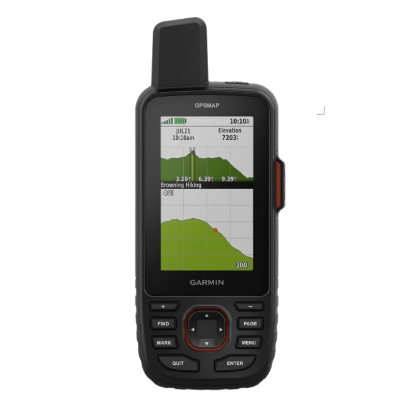
The GPSMAP 67i comes preloaded with worldwide basemaps and detailed TopoActive maps, enabling users to navigate confidently in various environments. It also supports downloadable satellite imagery, allowing users to view realistic terrain details directly on the device. These mapping capabilities help improve route planning, navigation accuracy, and situational awareness during outdoor activities.
The integrated barometric altimeter provides elevation data for accurate ascent and descent tracking, while the built-in three-axis compass ensures dependable directional guidance even when standing still. These features make the GPSMAP 67i particularly useful for mountaineers, hikers, surveyors, and outdoor professionals who rely on precise navigation information.
In addition to satellite communication and navigation capabilities, the GPSMAP 67i supports Bluetooth®, Wi-Fi®, and ANT+® connectivity. These wireless technologies allow seamless synchronization with compatible devices and applications, making it easier to transfer routes, waypoints, maps, and activity data.
Users can pair the GPSMAP 67i with compatible smartphones and Garmin applications to plan routes, manage adventures, and share tracking information with friends, family, or colleagues. This connectivity enhances the overall outdoor experience by combining robust navigation hardware with convenient digital tools.
The versatility of the GPSMAP 67i makes it suitable for a wide range of applications. Outdoor enthusiasts can rely on it for hiking, trekking, camping, geocaching, and mountaineering. Wildlife researchers and environmental scientists can use its accurate positioning and extended battery life for field data collection. Search and rescue teams benefit from the device’s communication capabilities and emergency response features, while surveyors and field technicians appreciate its reliable navigation performance.
Because the GPSMAP 67i combines navigation, communication, safety, and mapping functions into a single device, users can reduce the amount of equipment they need to carry while improving operational efficiency and safety.
The GPSMAP 67i is designed for users who demand reliability in environments where traditional communication and navigation systems may fail. Its advanced multi-band GNSS support, satellite communication capabilities, long battery life, rugged construction, and comprehensive mapping features make it one of the most capable handheld GPS devices available today.
Whether you are exploring remote wilderness areas, conducting professional fieldwork, or preparing for your next outdoor expedition, the GPSMAP 67i provides the confidence, safety, and precision needed to navigate with certainty. It is a powerful tool for anyone who values dependable navigation and communication in the most challenging environments.


Reviews
There are no reviews yet.